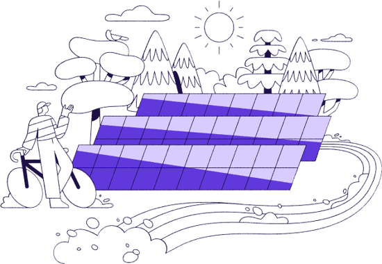
Identify top solar sites. Design and collaborate.
A single hub to triple your greenfield project pipeline growth with unmatched ease. Tailor-made for utility-scale solar developers.
TRUSTED BY


.svg)

.svg)
.svg)

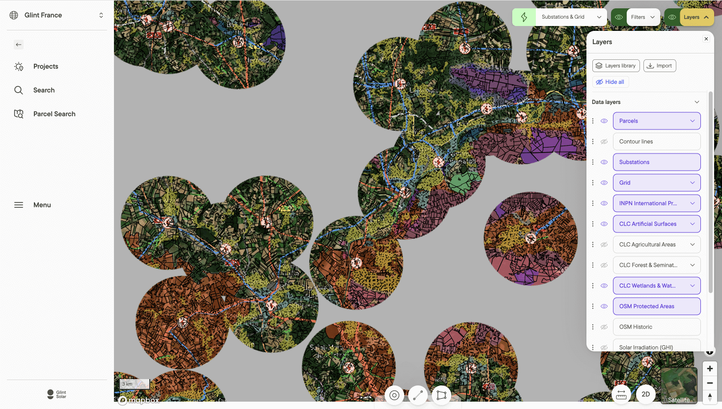
Prospect or evaluate sites 10X faster
A comprehensive and repeatable site selection process in minimal time:
- Swiftly analyze thousands of sites
- Identify relevant opportunities and avoid red flags
- Blend GIS data with topographical analysis for an accurate evaluation of buildable areas
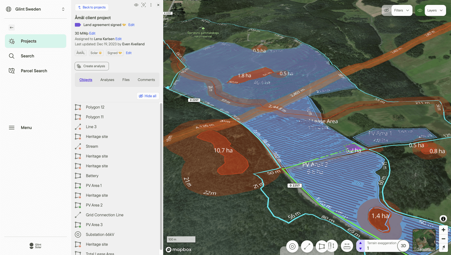
Pre-design and analyze sites in a snap
Bid farewell to tedious, half-day tasks. Craft engineering-approved designs and reports within minutes, regardless of your technical background:
- Assess preliminary yield and project feasibility in a few clicks
- Mark exclusion zones, roads, grid connections, and more
- Quickly generate 3D project visualizations with elevation profiling
- Make updates, assess multiple layout scenarios, and adapt to feedback instantly
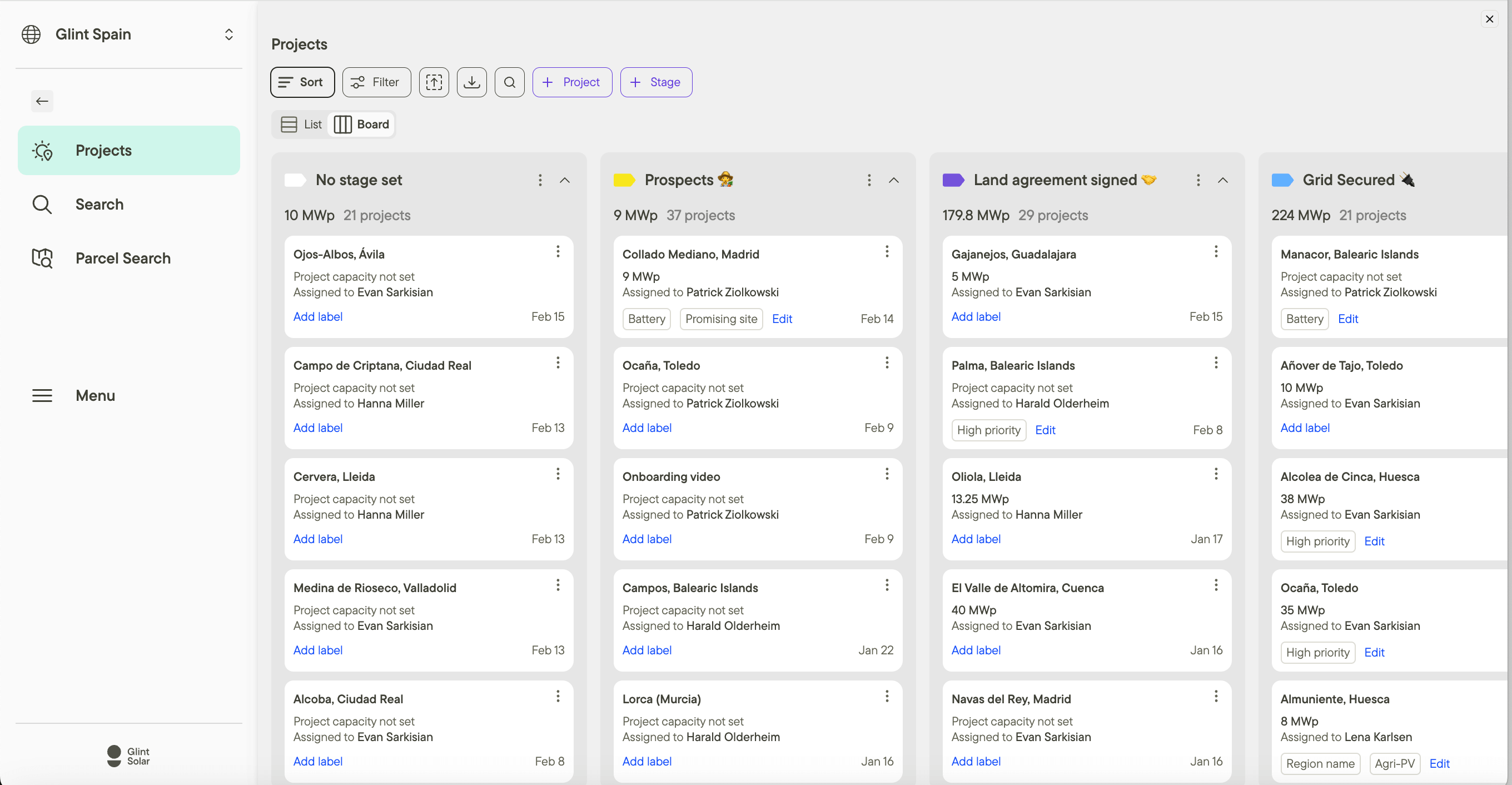
Boost collaboration and streamline project workflows
A collaboration hub to elevate your solar project management game:
- Gain full control over your projects and access all the data you need
- Keep track of your pipeline progress and identify blockers
- Easily transfer information between business development, GIS, and engineering
Don’t just take our word for it

“The ability to have GIS data and preliminary design in the same software has been a game changer for us. It allows us to build our pipeline quickly by having the necessary insights right from the start.”
Michael
Head of Solar Germany, ILOS Projects GmbH

“My team used this tool to increase our greenfield pipeline by almost 80 MW in one month.”
Eric
Solar Site Developer, Alight

“If we continue to prospect at this rate, the number of potential projects would be unmanageable!”
David Rodriguez
Investment Analyst, Quintas Cleantech
A SOLUTION FOR YOUR FULL TEAM
Maximize your team potential with Glint Solar
Not just a tool; a cohesive force that unites your entire solar development team
.png?width=500&height=405&name=LINEWORK%20(1).png)
Resources to help you navigate the solar sector
.png?width=1080&height=1080&name=Nordic%20grid%20system%20homepage%20(1).png)
%20(1).png?width=1080&height=1080&name=pvmagazine%20and%20Glint%20Solar%20webinar%20thumbnail%20(2)%20(1).png)
%20(1).png?width=1080&height=1080&name=solar%20vocabulary%20guide%20(3)%20(1).png)
.png?width=1080&height=1080&name=solar%20project%20collaboration%20(1).png)
Glint Solar in the media